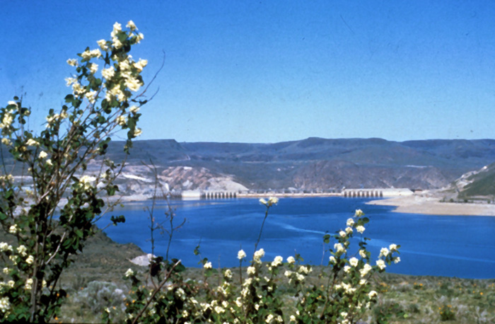
- Lake Roosevelt lies in a semi-arid zone: precipitation ranges from about 10 inches per year at the southern end to about 20 inches per year at the north end.
- Lake Roosevelt pumps 2.5 million acre feet (or over 814 billion gallons) of water into Banks Lake annually. Water from Banks Lake irrigates approximately 550,000 acres of farmland each year.
- The Lake Roosevelt watershed drains 44,969 square miles, almost 88% of those 44,969 square miles are in Canada.
- The water in Lake Roosevelt comes from glacial ice, lakes and precipitation (mostly melting snow pack in the spring). Close to 89% of Lake Roosevelt’s water comes from the Columbia River, 7% comes from the Spokane River and 4% comes from a combination of the Colville, Kettle and Sanpoil Rivers.
- Lake Roosevelt is over 150 miles long and provides over 630 miles of shoreline.
- Lake Roosevelt stores up to 9.4 million acre feet of water behind Grand Coulee Dam.
- Full pool (when the reservoir is filled to capacity) at Lake Roosevelt is 1290 feet, this is the elevation of the surface of the water above sea level. The elevation level of the lake can fluctuate as much as 80 feet over the course of a year. At full pool (elevation of 1290 feet) the surface of Lake Roosevelt covers close to 81,000 acres.
- The water depth of the lake varies from approximately 400 feet deep just upstream from Grand Coulee Dam to about 14 feet deep just below the Canadian border.
- Water temperatures in Lake Roosevelt are around 60 degrees Fahrenheit in June. There is very little temperature variation over the summer.


Lake Roosevelt’s semi-arid climate lies to the west of the Cascades and east of the Rockies.
In comparison to Western Washington it is much drier, with summers that are hotter and winters that are colder. Average January temperatures in eastern Washington range from less than -7°C (20°F) to -1°C (30°F), often dropping down to -18°C (0°F). July averages are from 18° to 24°C (65° to 75°F). However, daytime temperatures are often above 32°C (90°F).
In addition, the climate within the Lake Roosevelt watershed varies a great deal from one end of the lake to the other. The southern portion of the lake near Grand Coulee is hotter and dryer. Average annual precipitation near the dam is about 10 inches. Area vegetation includes shrub steppe species like sagebrush and bitterbrush.
The areas around the northern end of Lake Roosevelt receive considerably more precipitation. The region around Colville, for instance, receives about 17 inches a year, enough to support ponderosa pine and Douglas-fir. As the lake gets closer to the Canadian border precipitation continues to increase, coming close to 20 inches annually at the Canadian border.
At higher elevations precipitation also increases dramatically. For instance, Chewelah Mountain, which is about eight miles west of Chewelah, receives well over 100 inches of snow annually.
The southern end of Lake Roosevelt is largely sage-steppe and irrigated agricultural lands.
In the mid-lake area there is a transition from sage-steppe to second-growth ponderosa pine. Bluebunch, wheatgrass, hard fescue, and forbs such as balsamroot, northern buckwheat, brittle prickly pear, alum root and lupine are common here. Shrubs such as sagebrush, bitterbrush, rabbitbrush, snowberry, greasewood, and service berry characterize this region. Trees in this portion of the watershed include: black cottonwood, ponderosa pine and Douglas-fir.
In the upper lake area, vegetation includes dense growths of ponderosa pine, Douglas-fir and grasslands, Alder, willow, hazelnut, and black cottonwood are common along waterways. Common shrubs include chokecherry, serviceberry and wild rose.
Listed by County/Reservation of Origin
| Spokane Indian Reservation and South Stevens County Castle Rock Creek Spokane River The Colville Indian Reservation/South Ferry County Barnaby Creek Brody Creek Cobbs Creek Cottonwood Creek George Creek Hall Creek Little Jim Creek Monaghan Creek Nez Perce Creek Ninemile Creek Sanpoil River Sixmile Creek Stranger Creek Threemile Creek | North Stevens County Alder Creek Chewelah Creek China Creek Colville River Deep Creek Deer Creek Hallam Creek Harvey Creek Hunter Creek Jennings Creek Magee Creek O-Ra-Pak-En Creek Onion Creek Pingston Creek Quillisascut Creek Rickey Creek Seriver Creek Stranger Creek | Lincoln County Hawk Creek Welch Creek Spokane River North Ferry County Big Sheep Creek Crown Creek Fifteenmile Creek Flat Creek Kettle River LaFleur Creek Martin Creek Nancy Creek Rattlesnake Creek Roper Creek Sherman Creek |

There are approximately 75 species of mammals, 200 species of birds, 15 species of reptiles and 10 species of amphibians in the Lake Roosevelt area.
Large mammals include black bear, elk, mountain lion, whitetail deer, mule deer, and moose. California Bighorn Sheep were recently introduced to the area. Smaller mammals include: beaver, river otter, muskrat, mink, badger, raccoon, skunk, bobcat, coyote, red fox, porcupine, cottontail rabbits, ground squirrels, chipmunks, yellow-bellied marmot, pika, bats, gophers, rats, and deer and house mice.
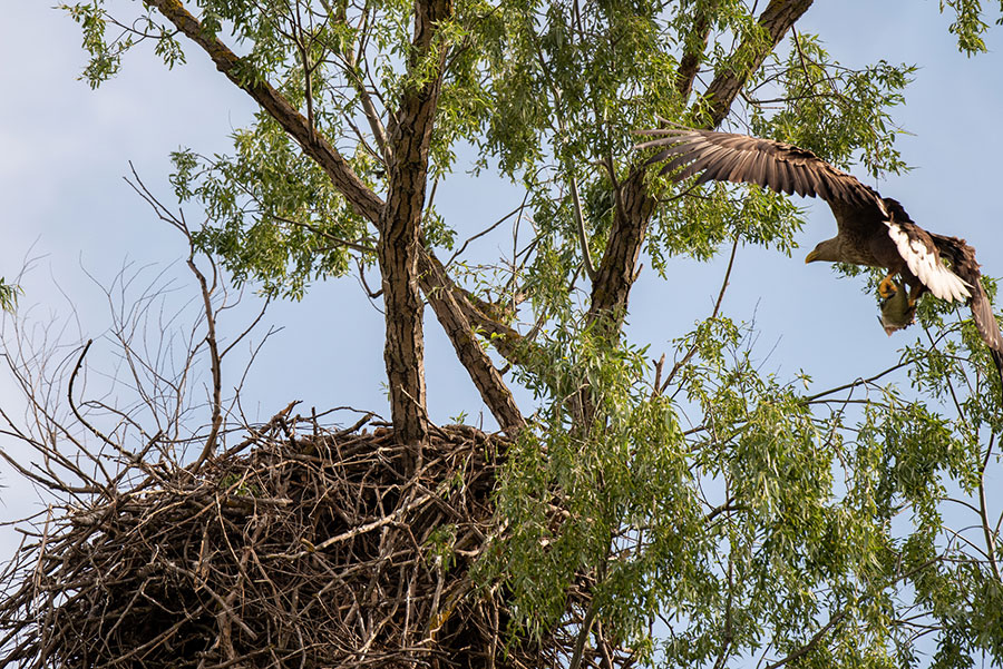
Birds found in the watershed include raptors such as: osprey, golden eagle, bald eagle, prairie falcon, red-tailed hawk, northern harrier, and American kestrel. Passerines include swallows, finches, jays, chickadees, kinglets, ravens, magpies, robins, sparrows, blackbirds, and juncos. Water birds include: mallards, pintails, teal, goldeneyes, redhead canvasback, western grebe, coot, lesser scaup, common merganser, common loon, and Canada geese. Shorebirds include: plovers, northern killdeer, spotted sandpiper, gulls, snipe, common grebes and yellowlegs. Grassland birds include: western sage grouse, Columbia sharp-tailed grouse, mourning dove, blue grouse, band-tailed pigeon, pheasant and turkey.
Lake Roosevelt watershed reptiles and amphibians include: sage brush lizard, western rattlesnake, gopher or bull snake, western terrestrial garter snake, bullfrog, western toad and various salamanders.
Native species of fish in the area include: kokanee, rainbow trout, bull trout, white sturgeon, burbot, lake whitefish, minnow, sculpin and sucker species. Introduced species include: brook trout, brown trout, walleye, yellow perch, largemouth bass, smallmouth bass, black crappie, white crappie, sunfish and yellow bullhead.
Some of the species found around Lake Roosevelt’s watershed are endangered, these include: peregrine falcons, gray wolf, woodland caribou, bald eagles, grizzly bear, bull trout and Canada lynx.
There are also many species whose decline is a matter of concern, some of these include: ferruginous hawk, Canada floater, Columbia sharp tailed grouse, Columbia spotted frog, loggerhead shrike northern goshawk, bull trout, and white sturgeon.

